BRITISH COLUMBIA –
Geoscience BC published today the data from its Search Phase III project, an airborne mineral survey of north central and northeast British Columbia. The data is intended to support the hunt for metals such as copper.
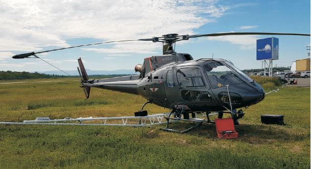
[caption id="attachment_1003721769" align="alignright" width="300"]
 One of the two helicopters that flew the Search Phase III magnetic survey. (Image: Geoscience BC)
[/caption]
The Search Phase III projects covers an area of 9,600 km
2 between the Kemess underground mine in the north to near Mackenzie. Helicopters equipped with ultra-sensitive magnetometers flew a grid 80 metres above ground, racking up 40,000 km (or once around the Earth).
Information about Search Phases I, II and III is available at
www.Geosciencebc.com/s/SearchProject.asp.

Comments