Advanced Navigation debuts Boreas 50 Series for precise mining positioning
Advanced Navigation announced an expansion of its Boreas range with the new 50 Series, a high-performance fiber-optic gyroscope (FOG) inertial navigation system […]
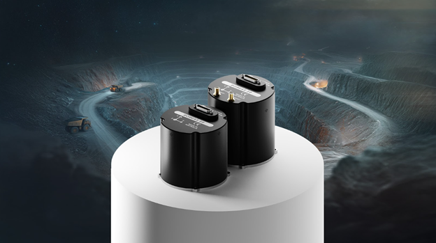
Advanced Navigation announced an expansion of its Boreas range with the new 50 Series, a high-performance fiber-optic gyroscope (FOG) inertial navigation system (INS). The 50 Series provides rapid North-seeking capabilities in challenging GNSS-denied mining environments, enabling accurate positioning when satellite signals are unavailable. It includes two variants: the A50, designed as an attitude and heading reference system (AHRS), and the D50, a strategic-grade INS. Both are equipped with a North-seeking gyrocompass that can quickly determine true North.
The D50 features all-band GNSS receivers, which enhance signal availability, heading accuracy, and resilience in difficult environments. Powered by Advanced Navigation’s sophisticated sensor fusion algorithms, the series offers reliable, intelligent navigation within a compact, optimized form factor.
Maxmilian Doemling, head of product at Advanced Navigation, stated, “Accurately determining position and heading remains a persistent challenge in mining operations. This limitation not only slows down automated systems but also makes precision tasks more difficult than they need to be.”
He explained that the Boreas 50 Series easily integrates into both new and existing platforms, providing fast and reliable positioning and North-seeking capabilities where traditional systems struggle. The solution ensures continuous performance in even the toughest environments, minimizing downtime and supporting long-term operation with high availability and a clear return on investment.
The Boreas 50 Series boasts real-time North-seeking gyrocompassing that detects Earth’s rotation to determine true North independently of GNSS signals or magnetic interference. Its compact form weighs 910 grams, making it suitable for space- and weight-constrained platforms. Advanced Navigation’s proprietary sensor fusion algorithms interpret sensor data dynamically, adjusting in real time based on environmental conditions and sensor reliability, which ensures accurate state estimation even when GNSS signals are lost.
The D50’s all-band GNSS capability includes dual antennas supporting the newer L6 band, facilitating faster convergence to centimetre-level accuracy and improving performance in signal-challenged environments by reducing errors caused by multipath interference. The series integrates seamlessly into both new and legacy platforms, streamlining upgrades, reducing installation time, and lowering costs across various mining applications.
GNSS capability. CREDIT: Advanced Navigation.
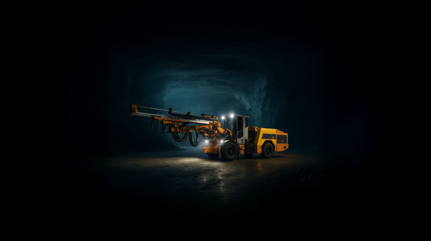
In underground haulage, the 50 Series provides accurate position and heading data, overcoming GNSS-denied zones to improve productivity and safety. For downhole sensing, it enables precise steer drilling, maximizing ore recovery and reducing dilution, shifting decision-making from reactive to proactive. It also supports rail asset monitoring by creating a comprehensive digital overview of underground railway networks, enhancing safety and reducing maintenance expenses.
The Boreas 50 Series offers heading accuracy of 0.5 degrees secant latitude, roll and pitch accuracy of 0.03 degrees, and positional accuracy of 0.01 meters CEP50. Alongside this, Advanced Navigation is upgrading its flagship INS solutions to include all-band GNSS support across models such as the Boreas D Series, including the D70 and D90, and the Certus Evo. These enhancements significantly improve performance, reliability, and coverage in demanding mining environments by leveraging advanced correction services on L6/E6 frequencies, enabling faster convergence and increased robustness.
The company emphasizes its commitment to availability, with products supported by a vertically integrated manufacturing process that guarantees industry-leading lead times—ready in weeks rather than years—and backed by a three-year warranty.
A person in a white coat holding a battery. CREDIT: Advanced Navigation.
Advanced Navigation’s global team of experts collaborates closely with system integrators, OEMs, and end-users to deliver tailored solutions that address common industry challenges related to integration, cost, and risk. Through engineering excellence, quick delivery, and dedicated customer support, Advanced Navigation is driving the advancement of autonomous mining technologies.

Comments