Major Drilling, KORE GeoSystems and DGI Geoscience mark one-year milestone in strategic partnership
Major Drilling, KORE GeoSystems, and DGI Geoscience are celebrating the one-year anniversary of their strategic partnership. This collaboration is transforming the integration […]
Major Drilling,KORE GeoSystems, and DGI Geoscience are celebrating the one-year anniversary of their strategic partnership. This collaboration is transforming the integration of drilling operations and geological data collection through innovative digital workflows.
Over the past year, the partnership has made significant strides in streamlining the journey from core recovery to actionable geological insight. By combining the strengths of a global drilling leader with the latest advances in geoscience logging and AI-powered software, the three companies have delivered an end-to-end solution that provides high-quality geological data swiftly and efficiently.
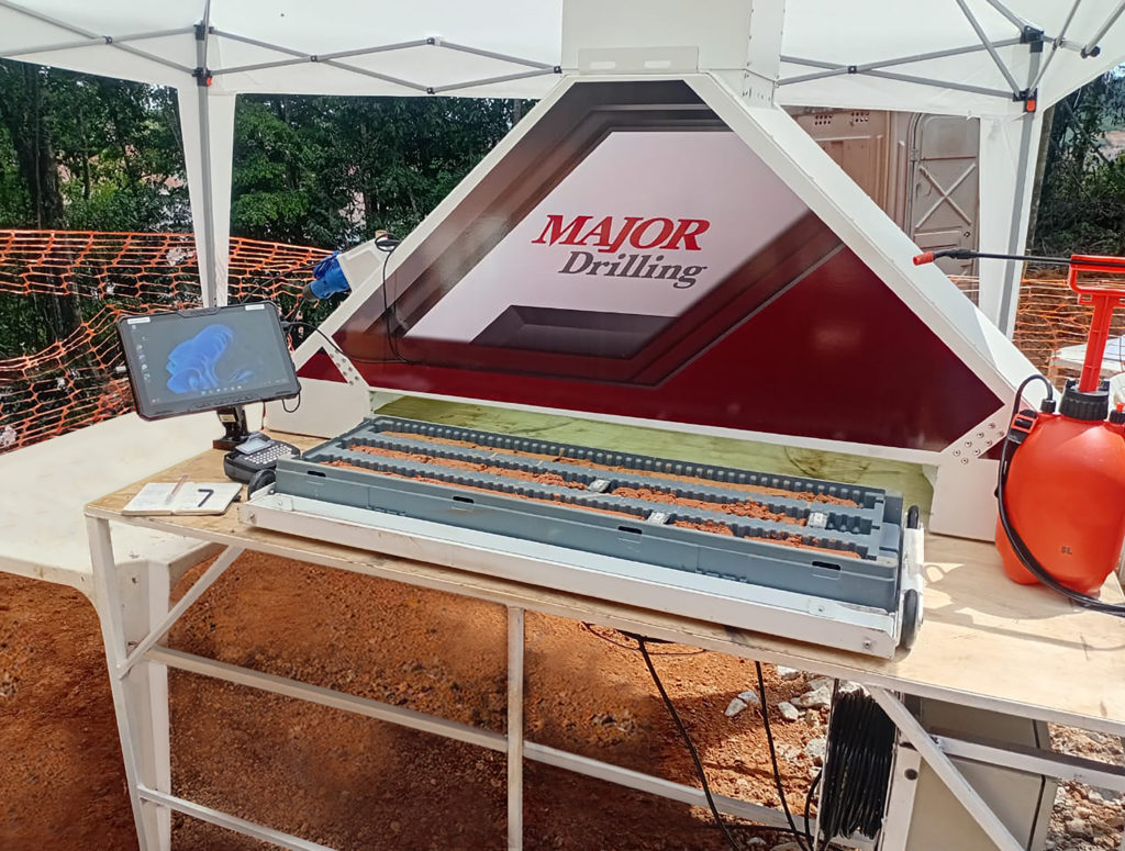
The partners achieved a major milestone by designing and deploying a drill side imaging unit, with Major Drilling and KORE GeoSystems working closely together. This pioneering system saw its first deployment this year in Brazil with key client G Mining Ventures, where it has proven its capabilities in live drilling scenarios.
Julie-Anaïs Debreil, vice president of geology and resources at G Mining Ventures, said: “We congratulate Major Drilling on this milestone and thank them for inviting G Mining to pilot the new drill side imaging unit. It’s exciting to finally see meaningful innovation coming from a drilling company with Major Drilling leading the way. Their unique integration of drilling and imaging services, along with KORE’s logging automation, is putting real-time core photos in our hands and allowing us to run a more responsive and efficient drill program at the Tocantinzinho gold project.”
G Mining is benefitting from the drill side partnership’s delivery of real-time core photos, allowing them to review images against their geologic model from anywhere in the world. This orebody knowledge helps run an agile drilling program, with informed decision-making on whether to cut or extend the hole based on geology.
Vince Gerrie, CEO of KORE GeoSystems, said the following about the Starlink connection at the rig: “High resolution core images are remotely accessible from anywhere in the world within seconds of being captured at the drill rig. AI tools automatically structure, depth reference and segment the images to instantly provide quick logs such as RQD [Rock Quality Designation].”
By capturing RQD before moving the rock, the team provides the most accurate representation of the rock. The AI software delivers consistent, repeatable, and auditable results. As the drilling team photographs the core, geology helpers can focus on other essential tasks. Now, the partnership’s imaging unit is poised to enter full production, with the first few units under construction and key customer discussions underway.
Major Drilling core imagining unit. PHOTO: Major Drilling.
Gerrie explained: “We’ve worked with Major Drilling closely to build and deploy the imaging unit prototype, and we’re very excited it’s now in the field,” There’s more to come - this first success has proven the model, and now we’re ready to ramp up.”
Meanwhile, DGI Geoscience has advanced the integrated “Drill > Image > Automate” workflow by delivering high-resolution geoscientific logging and interpretation directly at the drill side. This real-time, in-field collaboration accelerates geological understanding and ensures the team captures consistent, high-quality insights from every hole.
Chris Drielsma, president of DGI Geoscience, commented: “Our shared vision was to transform drilling into a real-time source of geological intelligence—layering downhole measurements onto drill results to give clients immediate, actionable insight. By combining technical depth with field execution, we’re enabling faster decisions, reducing uncertainty, and maximizing the value of every metre drilled.”
Throughout the year, the teams worked together to bring this offering to market—building operational workflows and educating clients on the full capabilities of the system. As a result, interest from operators has grown significantly.
Marc Landry, chief technology officer of Major Drilling, said: “Over the past year, we’ve seen the value this partnership brings to our clients in the field. Bringing digital innovation to the drill site is a natural evolution—and through this collaboration, we’re offering a seamless, future-ready experience.”
As the partnership enters its second year, the companies remain focused on continued deployment and innovation, delivering meaningful gains in speed, data quality, and operational integration across the mining value chain.
Comments