[caption id="attachment_1003748702" align="alignnone" width="603"]
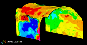
LiDAR image from the Argyle mine.[/caption]
Hovermap mobile LiDAR scanner improves safety and areal coverage in convergence monitoring
In December 2019, Rio Tinto trialled Hovermap for convergence monitoring at its Argyle Diamond Mine, in Western Australia. The trial showed LiDAR accuracy is sufficient for displacement monitoring and provides superior areal coverage of target areas. Extraction drives (200m) were scanned in 7 minutes using cost-effective vehicle-based data collection, delivering a significant reduction in underground exposure for Rio Tinto personnel in high-risk areas where heavy vehicles operate. Point cloud data is easily imported into mine CAD software enabling engineering, geotech, geology, and survey teams to use the data for multiple purposes: change monitoring, underground stockpiles, construction progress, clash detection, lithological contacts, and bolt location and spacing, etc.
The comprehensive and accurate convergence data delivered by Hovermap provides a basis for improved safety, decision-making and remediation planning at underground sites.
Download the full paper.

Comments