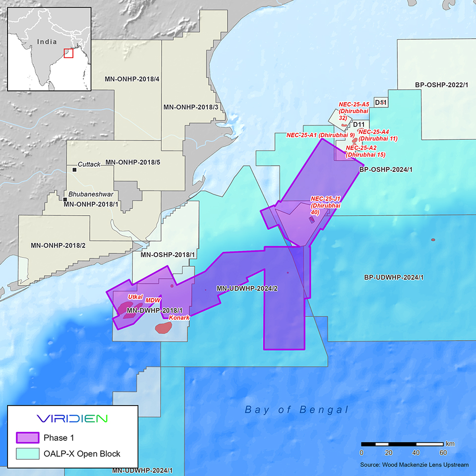
Viridien announced a new multi-client data initiative targeting India's offshore basins, aiming to enhance data-driven exploration for industry operators. The project begins with phase 1, focusing on reimaging and merging approximately 9,000 sq. km of 3D seismic data over the offshore East Coast Mahanadi Basin.
Viridien operates as an advanced technology, digital, and Earth data company focused on resolving complex natural resource, digital, energy transition, and infrastructure challenges.
The company expects to deliver fast-track results by June 2026, with final data available by year-end.
The phase 1 Mahanadi Basin project seeks to improve imaging quality over established petroleum system areas and deeper water zones where legacy data limitations have hindered exploration of new thermogenic plays. Viridien will utilize advanced imaging technologies, including time-lag full-waveform inversion (TLFWI) and least-squares PSDM (LSQPDSM), to produce seamless, high-quality 3D datasets.
“The innovative imaging technology and regional expertise provided by Viridien, combined with phased project expansion throughout the Mahanadi Basin, will drive new exploration and investment opportunities for emerging plays, and support both ongoing and future bid rounds," Dechun Lin, head of earth data at Viridien, said.
More information is posted at www.ViridienGroup.com

Comments