From wheel loader to point cloud: How machines become survey tools
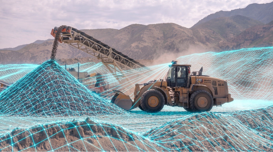
A wheel loader makes its daily rounds. Material is loaded, moved, piled up here and taken somewhere else again. Once a month a surveyor comes to the site, but by the time the data is processed and available to the team, it no longer reflects what is happening on site. Inventory numbers are outdated, volume reports lag behind the reality, and operational decisions are based on assumptions rather than accurate measurements.
What if the very machine moving the material could also survey it automatically while doing its regular work every single day?
Our approach: Surveying as a byproduct of daily operations
Rather than treating surveying as a separate task that requires dedicated equipment, specialized personnel and careful scheduling, we turn this task into an automated byproduct of everyday machine operations.
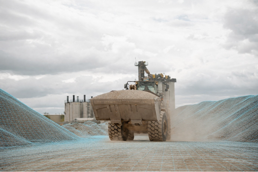
SDX-Compact, mounted on the roof of a wheel loader, dump truck or any other vehicle that is on site, captures the surrounding terrain with every movement the machine makes. There is no need to stop, no additional staff required and no coordination with external surveying companies. The machine automatically takes over that job by doing what it is used to doing every single day — the data is collected in the background.
Companies like Cemex UK, BHI and CRH already rely on this approach for continuous, automated data capture across their operations.
The system: SDX-Compact
The hardware is built for simplicity. SDX-Compact combines two global navigation satellite system (GNSS) antennas for survey-grade positioning, a light detection and ranging (LiDAR) scanner for 3D terrain capture and three optional cameras for continuous photo documentation and point cloud colourization. All components are integrated into a single compact unit that mounts directly onto the machine’s roof.
The system is a plug-and-play solution. There are no calibration procedures in the field, no structural modifications to the machine and no weeks of training required before it can be used productively. There is zero engagement from the operator needed. Mounting it on the machine takes minutes and data collection begins as soon as the power is on.
From periodic snapshots to continuous coverage
Traditional surveying in quarries, aggregate operations and larger earthmoving sites follows a familiar pattern: a measurement is taken at fixed intervals, perhaps weekly, monthly or quarterly. Between those intervals, teams work with estimations rather than actual numbers. The actual state of stockpiles, cut and fill progress or material movements remains uncertain until the next scheduled survey.
This approach works when decisions are made at those intervals. But in reality, dispatchers plan daily, customers expect reliable delivery quantities, and regulatory bodies demand complete documentation trails. The gap between data and reality grows with every working day.
SDX-Compact eliminates that gap. Because the machine scans its surroundings with every pass it makes, terrain data updates continuously. There is no waiting for a surveyor’s availability, no weather-dependent drone window and no data processing backlog. The site model updates itself as work progresses.
SDX-Cloud: One platform for all surveying data
All terrain data captured by SDX-Compact is automatically uploaded to SDX-Cloud — Sodex Innovations’ central data platform. Drone surveys, terrestrial scans and data from other surveying tools can be imported alongside machine-captured scans, creating a single, unified source of truth for all geospatial data on a project.
SDX-Cloud offers teams access to the following:
- Real-time dashboards displaying stockpile inventories and volume changes, updated automatically with every machine pass.
- Volume calculations with automated tonnage conversion based on material classes.
- Target terrains versus as-built comparisons to track progress against design surfaces.
- Historical terrain development over time.
- Exportable reports for billing, regulatory compliance and stakeholder communication.
- Drone data processing directly within the platform, eliminating the need for separate software.
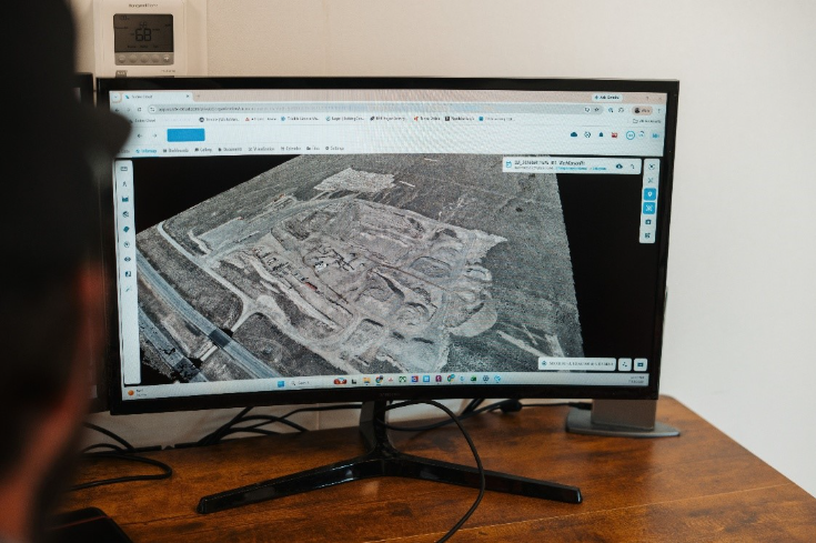
The key principle behind SDX-Cloud is consolidation. Many operations already use multiple data sources: drones for periodic overviews, GNSS rovers for control points or perhaps terrestrial scanners for specific tasks. The challenge is not collecting data; it is bringing it all together in a way that enables decisions. SDX-Cloud serves as that central hub. Machine-based scans deliver the daily operational picture, while drone flights and other methods complement it at larger intervals. Everything ends up in one system, one analysis environment, one set of dashboards.
Where it fits and where it does not
Machine-mounted surveying is designed for continuous operational data. It excels at stockpile monitoring, earthmoving progress tracking, material flow documentation and automated inventory management. Anywhere a machine moves regularly, useful data is generated.
For one-time detailed captures in tight spaces, spot checks on individual slopes or handheld documentation tasks, Sodex offers SDX-PocketScan, a mobile scanning solution that works with LiDAR or photogrammetry scanning through the iPhone’s built-in LiDAR and cameras for quick, georeferenced 3D scans on the go.
For regulatory boundary surveys requiring the highest precision standards, a licensed surveyor with classical equipment remains the right choice. This technology does not aim to replace every surveying method. The goal is to fill the gap between periodic measurements with continuous, automated data, and to give teams a reliable daily picture of their site without additional effort.
The bigger picture
The construction, mining and aggregates industries are not short on surveying technology. They are short on surveying frequency. The tools exist to measure anything with the highest accuracy but deploying them daily is impractical for most operations. The result is a documentation gap. Accurate data exists at sparse intervals with guesswork filling the space between.
This technology addresses this by making data collection invisible. It happens because of normal work, not as a scheduled task. The operator keeps operating. The dispatcher gets daily numbers. The site manager sees progress in real time. The surveyor can focus on tasks that genuinely require their expertise, rather than routine documentation that any machine could handle.
Sodex Innovations enables earthmoving, aggregate, pipeline and infrastructure companies to make smarter decisions through real-time data derived from automated terrain documentation. Learn more at sodex-innovations.com.
Related Posts
Haver & Boecker Niagara hires new Alta., Sask., territory manager
November 12, 2026
Haver & Boecker Niagara hires new Alta., Sask., territory manager
The operational heartbeat of mining leadership
November 12, 2026
The operational heartbeat of mining leadership
Awalé extends gold beyond Ivory Coast resource
November 12, 2026
Awalé extends gold beyond Ivory Coast resource
NVRO Metals closes $35M private placement, plans Northern Territories acquisition

Sponsored: CAUR aims to take guesswork out of deep drilling
November 11, 2026
Comments