Subsurface imaging: The rise of new technologies
In an era defined by the urgent need for more efficient, sustainable, and financially sound mining practices, the methods used to explore the subsurface are under scrutiny. Traditional drilling, once the undisputed cornerstone of mineral discovery, is increasingly seen as too slow, too expensive, and too limited for today’s complex mining landscape. As exploration targets become deeper, more remote, and more technically challenging, the industry is turning toward innovative technologies that promise to transform how resources are identified and valued.
The future of subsurface exploration is poised to be shaped by advancements in artificial intelligence (AI), remote sensing, and autonomous systems. Subsurface imaging paired with AI engines is expected to enhance the speed and accuracy of decision-making during exploration activities. As demand for critical minerals rises, integrating these cutting-edge technologies will be essential for meeting global resource needs efficiently and responsibly. The mining sector is now ripe for disruption and becoming cleaner, safer, and far more precise.
Rethinking risk in the mining industry
According to McKinsey’s 2024 report, “The Capex Crystal Ball: Beating the Odds in Mining Project Delivery,” approximately 83% of major mining and metals projects have experienced significant cost and schedule challenges, with more than 40% experiencing capital expenditure overruns, while project timelines were delayed in 20% to 30% of the cases. The outlook is even more concerning for megaprojects valued at $1 billion or more, where the incidence and magnitude of overruns are notably higher.
Deviations from cost and schedule estimates often arise from poor initial budget or time assessments or from poor execution. It has been shown that two-thirds of cost overruns and schedule delays could be attributed to poor initial assessments, with the remaining one-third related to poor execution. According to McKinsey’s report, one of the three notable things that the “winners” (companies that experience less cost overruns) do right is investment in the rigorous feasibility studies. Surprisingly, the solutions to these inefficiencies are not in abundance.
Critical minerals, critical moment
Global venture funding has been heavily skewed toward software and emerging technology while investment in mining technology has been volatile. Mining-tech startups have been facing funding hurdles, which directly impact their advancements.
This landscape is slowly changing with the increased demand for raw materials and growing trade tensions between regions. Materials such as copper and nickel, which play key roles in the energy transition technologies, are expected to experience significant demand growth. In fact, for these two metals alone, capital expenditures of $250 billion to $350 billion could be needed by 2035 to expand and replace the depletion of existing supply.
Can the traditional methods keep up?
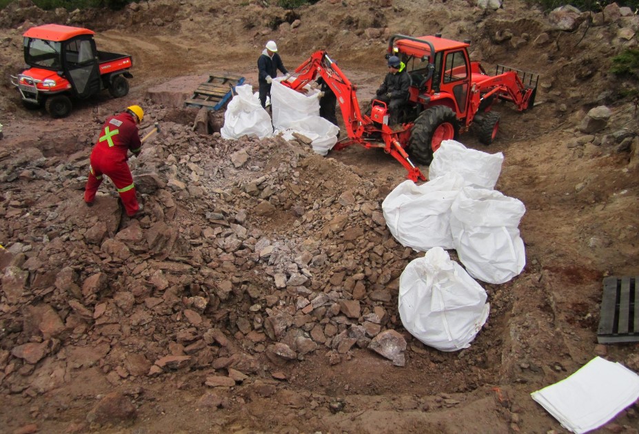
Borehole drilling has long been the backbone of both greenfield and brownfield mineral exploration, but its limitations are hard to ignore. Boreholes provide only point-specific data, offering a narrow view of subsurface geology and leaving large areas between drill sites unexplored. Interpolating this data to fill the gaps adds uncertainty to geological models and increases the risk of costly errors. In greenfield projects, where little prior geological information exists, this can lead to missed opportunities or wasted investment. On the other hand, in brownfield sites with known geology, drilling can overlook critical features like karsts or old mine workings. The high time and cost demands of drilling further reduce its efficiency as a stand-alone method.
Revival of old mines
More companies are reactivating previously abandoned mining assets — once considered financial liabilities — as they reassess profitability in the context of the new economy. In Canada’s Yukon Territory, the Selkirk First Nation recently took over the Minto mine — once a significant copper producer — after its previous owner declared bankruptcy. In Quebec, Doré Copper Mining, now under Australia’s Cygnus Metals, is reopening a site dormant since 2008. In Spain, Denarius Metals is reviving the Aguablanca mine following a seven-year hiatus. To minimize uncertainty and confidently evaluate the return on investment (ROI), investors now demand higher-quality data upfront.
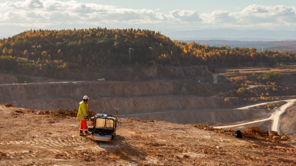
Traditional borehole drilling methods often fall short in identifying the full range of risks associated with reviving old mines, including outdated plans, newly formed cavities, and other unexpected challenges. This gap has created opportunities for innovation in geophysical technologies. One rising player in this space is the European startup “Widmo,” which has recently expanded into Canada and the U.S. to address growing demand for advanced, data-driven subsurface imaging technologies.
The rise of smart geophysical methods in mining
Zygmunt Trzesniowski, one of the minds behind Widmo, combined his field expertise as a former Saudi Aramco engineer with seismic imaging technologies studied by Dr. hab. Andrzej Kułak, a physicist affiliated with the AGH University of Science and Technology and the Astronomical Observatory of the Jagiellonian University. His research adapted solar observation techniques — typically used in astrophysics — to monitor Earth-based phenomena using waveforms. Building on passive seismic imaging, Widmo’s solution integrates two innovations:
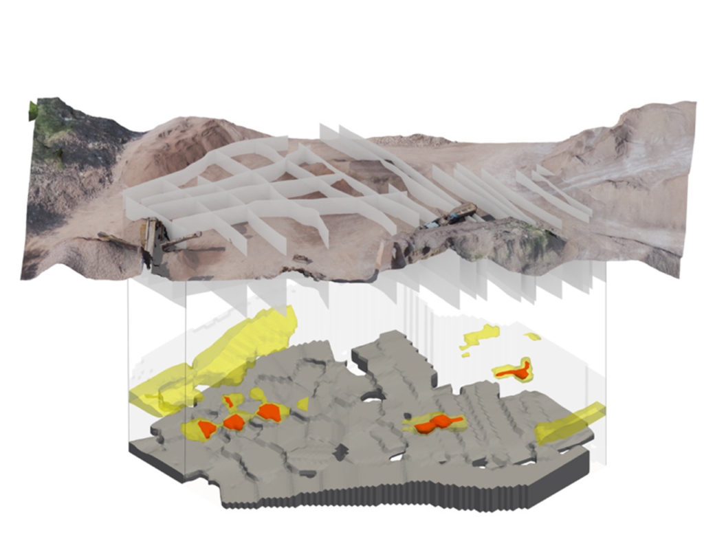
First, its Spectral Ground-Penetrating Radar (SGPR) combines frequency-modulated continuous-wave (FMCW) technology with a broadband antenna to detect the dielectric “fingerprints” of different materials across frequency domains.
Second, soon to be launched, is WIDMO Analytics — a machine learning (ML)-driven processing suite designed to automatically ingest borehole logs alongside SGPR data to generate real-time, continuous three-dimensional models.
On a broader mission, Widmo aims to bridge the gap between shallow, limited Ground-Penetrating Radar (GPR) technologies and deep geophysical methods like seismic imaging and high-resolution electrical resistivity tomography, making advanced subsurface exploration more accessible, faster, and far more precise.
Cost and time efficiency
The immediate time and cost savings of accurate subsurface scanning are easy to calculate. Mirosław Trzesniowski, Widmo’s CEO, notes that an exemplary hard-rock exploration over an area of 0.25 km2 would typically require approximately 150 boreholes, cost up to one million dollars, and demand more than 8,000 hours of drilling. Widmo’s profiling can save over $ 800,000 (80%) and more than 7,400 field hours. A survey of this size takes just three to four days. These efficiencies demonstrate how high-resolution scanning delivers full subsurface coverage in days, not weeks, radically lowering both capex and schedule risk. But the benefits go beyond cost savings: reducing capital risk — through more accurate data and diminished uncertainty — is the real payoff.
Safe ground starts here
These technologies offer significant advantages when used alongside borehole drilling. Time-lapse measurements enable ongoing subsurface monitoring, allowing detection of geological and tectonic changes over time. Advanced scanning methods also identify subsurface anomalies — such as cavities, voids, or fractures. This early detection helps reduce the risk of ground instability or collapse, ultimately enhancing worker safety.
Expert perspectives on geophysical integration
Leading experts in mineral exploration emphasize the transformative impact of integrating geophysical methods into traditional exploration workflows. In a previous interview, Aaron Tomkins, principal geoscientist at GBG Group, highlighted that combining geophysical data with geological insights enhances the accuracy of subsurface models, enabling more informed decision-making and reducing exploration risks. This integrated approach allows for the identification of mineral targets with greater precision, optimizing resource allocation and increasing the likelihood of discovery. The SGPR methodology is ideal for identifying rare earth minerals at shallow depths, up to 50 metres, based on dielectric parameters and ohmic resistivity. As the mining industry continues to evolve, the synergy between geophysics and geology is becoming increasingly vital for successful exploration campaigns.
Greg Wabik is a business development associate at Widmo Spectral Technologies.
Related Posts
Mining Day digs into Thunder Bay’s future
June 12, 2026
Mining Day digs into Thunder Bay’s future
Thibault & Associates acquired by trajectorE
June 11, 2026
Thibault & Associates acquired by trajectorE
New Found Gold expands team as Hammerdown remains on schedule
Conflict coltan from Congo linked to Sony, Microsoft, Nvidia supply chains
Comments