BRITISH COLUMBIA – Vancouver’s
Imperial Metals Corp. has completed the first nine underground holes in the Martel and Green zones below the Wight pit at its Mount Polley copper-gold mine 100 km northeast of Williams Lake. The zones were discovered in 2004 before the development of the Wight pit.
[caption id="attachment_1003717371" align="alignright" width="300"]
 Underground exploration plan map for the Martel zone at Mount Polley.
[/caption]
Highlights from the Martel zone include 110.0 metres grading 1.27% copper and 0.24 g/t gold in drill hole MU-17-7, which included 56.9 metres grading 1.90% copper and 0.37 g/t gold. The Martel zone measures approximately 130 metres long, 170 metres high, and 140 metres wide, perpendicular to the Brown Wall fault plane. Along its northeast fringe, the zone gives way to monzonitic wall rock and dikes.
Hole MU-17-8 was extended in length to intersect the Green zone mineralization where it intercepted 17.8 metres grading 4.49% copper and 1.44 g/t gold. The Green zone is hosted in a distinct style of breccia and is intermittent but can be very high grade.
Additional assays from this drill program are expected in March 2017, and then the resource estimate will be made as well as mining plans for the area. The Martel zone is roughly 400 metres east of the Boundary zone underground workings.
Additional details from the drill program are available at
www.ImperialMetals.com.
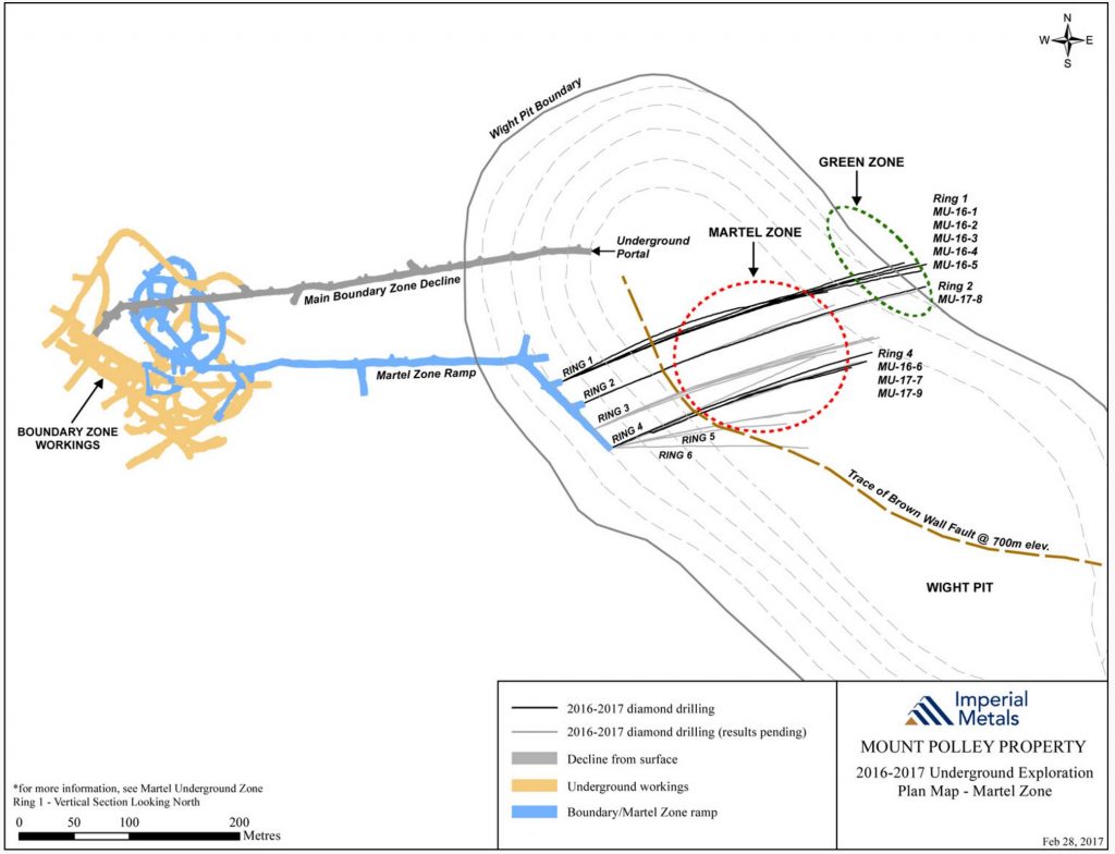
 Underground exploration plan map for the Martel zone at Mount Polley.[/caption]
Highlights from the Martel zone include 110.0 metres grading 1.27% copper and 0.24 g/t gold in drill hole MU-17-7, which included 56.9 metres grading 1.90% copper and 0.37 g/t gold. The Martel zone measures approximately 130 metres long, 170 metres high, and 140 metres wide, perpendicular to the Brown Wall fault plane. Along its northeast fringe, the zone gives way to monzonitic wall rock and dikes.
Hole MU-17-8 was extended in length to intersect the Green zone mineralization where it intercepted 17.8 metres grading 4.49% copper and 1.44 g/t gold. The Green zone is hosted in a distinct style of breccia and is intermittent but can be very high grade.
Additional assays from this drill program are expected in March 2017, and then the resource estimate will be made as well as mining plans for the area. The Martel zone is roughly 400 metres east of the Boundary zone underground workings.
Additional details from the drill program are available at

Comments